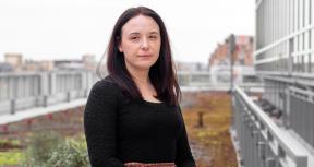
In the medical field, an image can produce the right diagnosis and ultimately save a life. This notion, transferred to surveying the complexities of global development, captivated Virginia Ziulu.
The geospatial analysis of the earth’s surface and the extraction of snapshots of information from vast bodies of knowledge to reveal key insights can impact many lives. This enormous potential of using images and other forms of data to diagnose the challenges present in today’s turbulent world, and the progress and impact of the efforts to address them, led her to pursue a career as a data scientist.
In this brief interview, Virginia takes us through her journey as a data scientist.
How did your journey as a data scientist begin?
I have always been drawn to leveraging data to gain insights into the complexities of our world. I was initially attracted by the rigor of quantitative analysis, and later in my studies I became fascinated with image data and its scientific and artistic ramifications.
I have had the fortune of developing most of my career as a data scientist in the World Bank Group. My work at the Bank Group has allowed me to hone my skillset and explore different angles of data science including data mining, financial modelling, natural language processing, and geospatial analysis.
How are data science applications enabling new frontiers in global development?
Data science can catalyze positive change in international development. By leveraging machine learning, predictive modeling, and other advanced analytics techniques, development practitioners can gain deeper insights into complex social, economic, and environmental challenges, thereby informing more effective policy formulation and intervention strategies.
Data science can also facilitate the identification of vulnerable populations and areas in need of assistance with greater precision. This results in targeted interventions that maximize impact with optimal resource allocation.
Data science can also feed the rigorous monitoring and evaluation of development projects. It enables stakeholders to assess progress, identify challenges, and make evidence-based adjustments in real-time.
How does data science strengthen the evaluation function at the World Bank Group? How are you applying data science into IEG’s work?
Data science provides evaluations with rich and detailed information that might not be captured by traditional data sources such as census and survey data.
A significant part of my role at IEG entails providing cross support to evaluation teams on the application of advanced data science techniques. These typically encompass image-based applications (used for geospatial analysis), and text-based applications.
Some examples of image-based applications I developed include modelling urban indicators from features extracted from digital images, creating flood risk maps (for IEG’s upcoming Tanzania Country Program Evaluation), estimating changes in mangrove cover and health over time (for IEG’s upcoming blue economy evaluation), and estimating water budgets and changes in arable land and groundwater (for IEG’s Morocco Country Program Evaluation).
Examples of text-based applications I developed include automatically extracting specific sections from documents, training classification models to predict categories across a taxonomy, and conducting sentiment analysis. I have been working with IEG’s gender evaluation team on leveraging natural language processing (NLP) to predict the existence of certain gender gaps in a large corpus of World Bank project documents (3,000+ documents).

I must address Artificial Intelligence (AI). I think AI, as a technology, is neutral, and as such it has the potential to be used for both beneficial and detrimental applications. The potential threats from AI are being actively studied from multiple angles, but I can mention some positive developments as well as some specific threats I perceive from my field.
On the negative side, a particular concern in computer vision is that of deepfakes (artificially generated media that is essentially indistinguishable from real media). This causes an increased risk of inadvertently training models on falsified data, which could eventually lead to incorrect predictions. This concern is also applicable to geospatial analysis, which heavily relies on remote sensing images.
On the positive side, as algorithms get more powerful and the availability of computing resources increase, I foresee multimodal learning becoming increasingly prevalent. By integrating various data types such as images, audio, and text, this approach promises to facilitate more intricate and nuanced analyses. I am also optimistic about the progress made by the field of XAI (eXplainable Artificial Intelligence), which encompasses algorithms designed to elucidate the inner workings of complex 'black box' models. Such advancements are likely not only to enhance our comprehension of these models but also to foster greater transparency in prediction processes with important implications in multiple fields including climate and financial modeling, healthcare and medicine, and more.
Are you interested in learning more from Virginia's work on data science and its applications at the World Bank Group? Don't miss IEG's upcoming symposium "Unlocking the Potential of Geospatial Analysis for Evaluation" which will take place in Washington, DC on April 11 from 9:00AM to 3:30PM. The symposium aims to explore the transformative potential of geospatial data in the field of evaluation and will bring together a diverse and interdisciplinary assembly of experts, researchers, and practitioners who are at the forefront of geospatial analysis and its applications in evaluation.


Comments
Virginia's journey and her…
Virginia's journey and her contributions within IEG serve as a model. I believe engaging Actuaries in this domain holds significant importance, particularly as mapping flood risks intersects with Actuarial endeavors in agricultural, climate and earth sciences. Prioritizing the forecasting of natural disasters through the Actuarial Climate Index could greatly assist IEG's work in the field of Data Science.
Add new comment